“Major storm events have caused a lot of street flooding, and it’s just going to get worse,” AmyBeth Willis, representative of the Save the Bay foundation, said. Lowland flooding has caused the City over $3.8 million in damages, with 56 atmospheric rivers having hit the West Coast as of 2025 alone.
The National Weather Service issued four flood watches for San Mateo County between Jan. 1 and Feb. 10. Menlo Park already uses a variety of storm drainage infrastructure to mitigate flooding impacts and alleviate concerns about street flooding and marshland destruction. Despite these structures, nuisance flooding and pooling still persist.
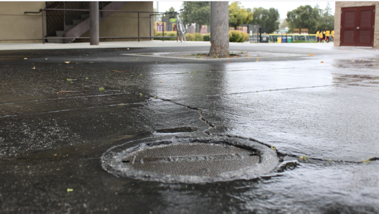
Most commonly, residents see large pools of water accumulate on roads like Bay and Middlefield. These puddles, called “nuisance floods,” result from undersized systems. For some areas, including M-A, dealing with nuisance floods is more complex than just adding more drain pipes.
“Bay Road is a nightmare when it floods. I drive a sedan, so going through always seems too risky, and it adds 10-15 minutes to what should be a 10-minute drive,” senior Arman Azadpour said.
“M-A is in Atherton, next to county land and the city, so this area is a bit complicated given the jurisdictional boundaries,” Menlo Park Public Works manager Azalea Mitch said.
The City of Menlo Park owns over 46 miles of stormwater drainage infrastructure, most of which is made up of drain pipes.
Because water flows directly into the delicate ecosystems of the Bay and its tributaries, the City must comply with strict environmental regulations. “When a project is proposed for development, we require that the stormwater runoff from the site is not increased,” Mitch said.
The process of environmental protection begins during the design process and carries through to the construction, impacting the final product. “Developers are required to build following low-impact development practices, meaning they must ensure that there is enough pervious surface to infiltrate stormwater that is generated on the site,” Mitch said. “During construction, the contractor is required to use best management practices to reduce the amount of silt and contaminants that can flow from the site and enter the stormwater system.”
“We’re seeing compounding flood risks, like pooling groundwater and rising sea levels, because of climate change. But, the fact that Menlo Park is part of the SAFER Bay project helps out.” Willis said.
The SAFER Bay project, or Strategy to Advance Flood Protection, Ecosystems Restoration and Recreation, is a public-private partnership that aims to engineer and build environmentally friendly infrastructure along 3.7 miles of the north side of the Dumbarton Bridge. The project received $50 million from the Federal Emergency Management Agency funding, $7 million in funding from Meta, and $10 million in funding from PG&E.
The project works with a number of grassroots environmental organizations like Save the Bay to restore salt-pond ecologies and protect federally endangered species. The project also seeks to account for the San Francisco Bay’s projected 3.5-meter sea level rise, proposing a levee system, a living shoreline side, and gated floodwalls. In tandem, the project seeks to protect existing infrastructure like Hetch Hetchy pipelines.
Presently, the project is still developing technical and engineering studies. While it aims to serve five different reaches, the project has only been approved for three of the five, with construction following in 2027.
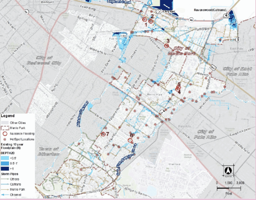
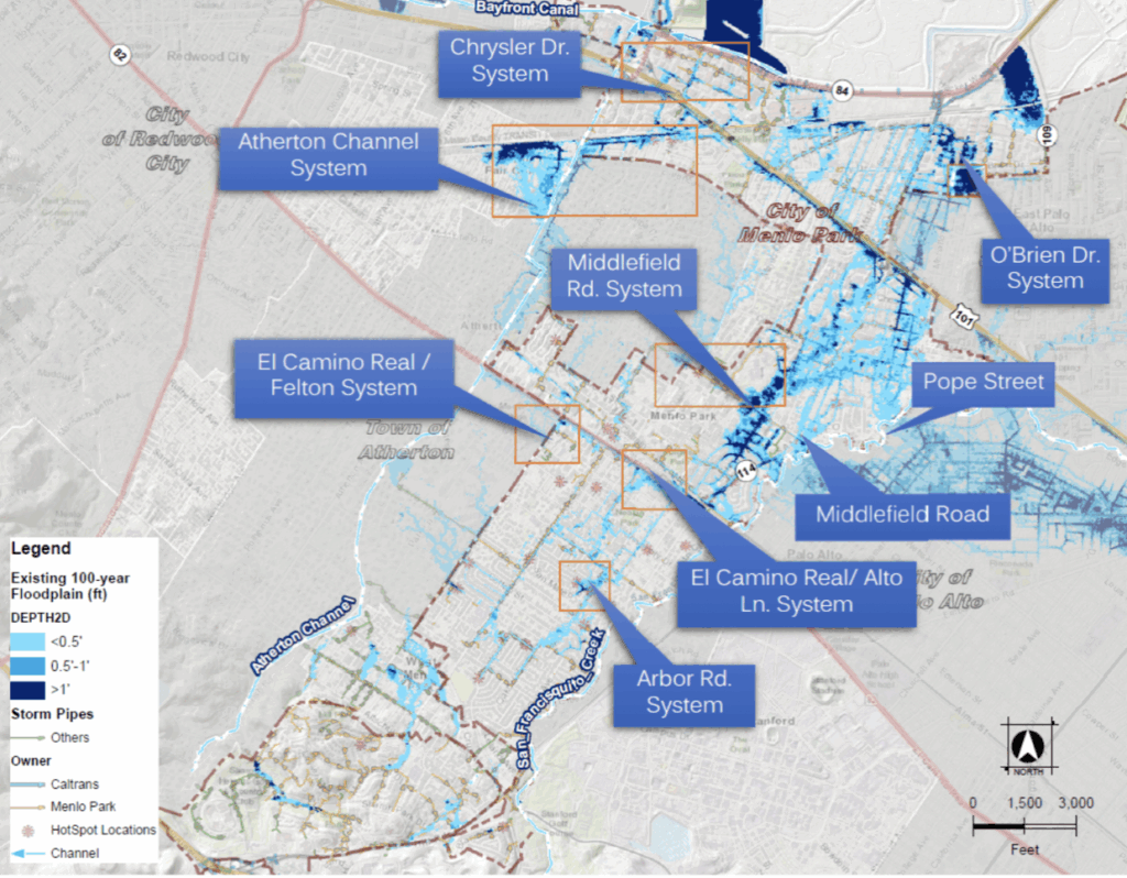
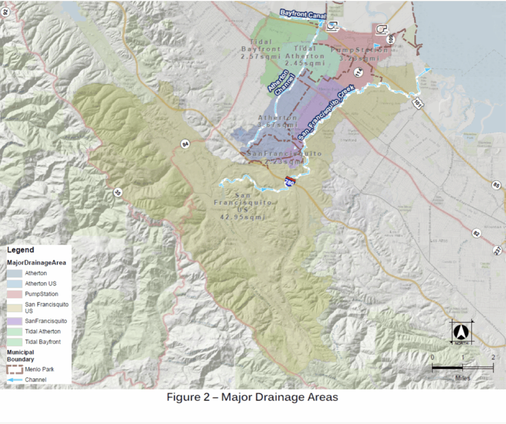
Runoff from Menlo Park is diverted to either the Atherton Channel, the San Francisco Bay Channel, or the San Francisquito Creek. From these drainage basins, water flows downhill into the San Francisco Bay.
Only one of these channels requires the water to flow uphill in order to reach the Bay. To achieve this, a pump is used to move the water. A public works crew routinely checks to ensure that filters are clean and pump stations are functional. Currently, Menlo Park’s Chrysler Pump Station, which was initially built in 1958, is being updated. The new pump is designed to combat predicted sea level rise in the San Francisco Bay. The project is set to be completed by 2026, partially funded by $5 million in FEMA funding. The Chrysler pump update is in efforts to help the City more adequately deal with 10-year-storm events.
The City also must comply with federal regulations like the Clean Water Act and the National Pollutant Discharge Elimination System Stormwater Discharge Permit, which aims to prevent pollution in the San Francisco Bay. In order to follow these regulations, the city works with the private sector, conducts inspections on businesses, and uses existing stormwater inlets to prevent trash from entering the Bay.
The burden of fixing flooding rests on property taxes. “Unfortunately, these projects are expensive, and we do not have enough to improve the system,” Mitch said. The city has over $40 million in needs, with the Chrysler Pump station renovation alone taking 10 million dollars in funding.
For residents who do see the ramifications of flooding, the City offers some support. Residents can pick up free sandbags at Menlo Park Fire Station No.77 or at the Burgess parking lot at Alma Street and Burgess Drive. Residents can also sign up for real-time alerts through San Mateo County Alert.